Capacity Building and Outreach
The Assam State Space Application Centre started functioning with an objective to develop Remote Sensing Techniques and its applications for Natural Resource Management in the state and to provide training and consultancy services in Remote Sensing and related areas to the user departments of various government and non government sectors. ASSAC has conducted training to impart and spread awareness in the field of Remote Sensing & GIS. Seminars/Workshop/Training programmes organized by the organization are:I. Assam State Meet on promoting space technology based tools and applications in governance and development
I. Assam State Meet:
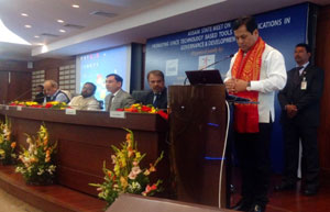
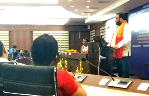
Assam State meet on promoting space technology based tools and applications in governance and development was organized jointly by Assam State Space Application Centre (ASSAC), Indian Space Research Organization (ISRO) and North Eastern Space Application Centre (NESAC) at Administrative Staff College, Guwahati on December 03, 2016. The Purpose of the meet was:
- to promote use of space inputs in governance and development
- need assessment by line departments for use space inputs as well as new initiative
- integrate the space technology in conjunction with conventional method
- to apprise and show case the large mass about various activities being carried out by State Remote Sensing Centre in association with ISRO using space technology for natural resource management.

|

|
II. District & Block level Workshop on Empowering Panchayati Raj Institutions Spatially (EPRIS):
It is an outreach programme for PRI’s for utilization of spatial data available in BHUVAN Geoportal developed by ISRO for activity planning as well as using of Android based Mobile Apps for geo tagging of Assets in BHUVAN Panchayat geo-portal. The District level workshop was held at Tezpur on 30th May,2017 in association with NESAC and District administration, Sonitpur.
Zilla Pramukh and Officials of Zilla parishad along with Block elected panchayat representatives and support functionaries from all blocks (Undivided Sonitpur district). All together there were 83 nos. of participants. The participants were demonstrated the BHUVAN Geoportal and its utilities and hands on training was imparted for utilization of mobile apps for geo tagging of assets.
The block level workshop was held in association with SIRD, Sonitpur at Biswanath Chariali for undivided Sonitpur ( which is now divided into two districts i.e. Sonitpur and Biswanath) on 7th and 8th of December,2017. During the workshop 215 Gram Panchayat (GP) officials (which represented 141 GP’s of undivided Sonitpur) were given hands on training on Android based Mobile Apps for Assets Mapping (i.e. geotagging of assets in Bhuvan Panchayat geoportal).
